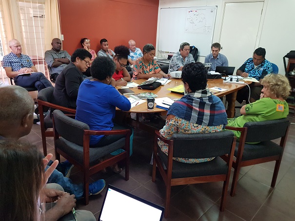
About
- Terms of Reference
- Action Plan 2014 – 2020
- PAWG Presentation at Annual Meeting, Suva, Fiji, July 2015
Members
- American Samoa Environmental Protection Agency
- Conservation International (CI)
- Coral Reef Advisory Group (CRAG) – American Samoan Government
- Deutsche Gesellschaft für Internationale Zusammenarbeit (GIZ)
- Marine Areas Network (FLMMA)
- Food and Agriculture Organization (FAO)
- International Union for Conservation of Nature - Oceania Regional Office (IUCN-ORO)
- Protected Areas Learning and Research Collaboration (PALRC)
- The Nature Conservancy (TNC)
- World Wide Fund (WWF)
- Wildlife Conservation Society – Fiji Country Programme
- Wildlife Conservation Society, Melanesia Program
Note - As of November 2022, the PAWG has been rebranded to the Pacific Area-based Conservation Network (PACoN), with a new terms of reference and membership. More information to come - WATCH THIS SPACE...
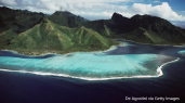
Pacific Coral Reef Action Plan 2021–2030
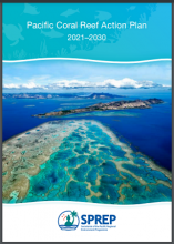
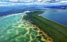
Many Pacific coral reefs are being damaged by habitat disturbance, pollution, fishing and climate change. Climate change is believed to be the greatest human-induced threat to corals in the Pacific region. The region needs an action plan to make cohesive decisions that will benefit coral reefs.
Pacific coral reef monitoring assessment
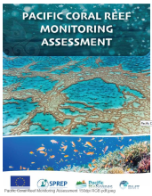
The assessment aligns with the Pacific Coral Reef Action Plan 2021–2030, supporting key action areas such as capacity building, habitat conservation, and research utilisation.
Pacific Islands Framework for Nature Conservation and Protected Areas 2021- 2025
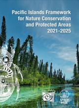
This Pacific Islands Framework for Nature Conservation and Protected Areas2021-2025 is the principal regional strategy document for environmental conservation in the Pacific.
Pacific Islands Framework for Nature Conservation and Protected Areas 2021-2025
This Pacific Islands Framework for Nature Conservation and Protected Areas 2021-2025 is the principal regional strategy document for environmental conservation in the Pacific.
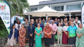
Pacific Islands Framework for Nature Conservation and Protected Areas 2021-2025

This new Pacific Islands framework for Nature Conservation and Protected Areas 2021-2025 was endorsed during the conference and subsequently at the 30th SPREP Meeting by 26 members countries and territories in 2021.
Pacific Islands Marine Portal

The Pacific Islands Marine Portal provides various information on the status of marine protected areas and much more.
Pacific Islands Ocean Conference (PIOC) Report, Heritage Hotel Honiara, Solomon Islands, 29 September - 3 October 2025.
The core objective of the conference was to provide a cross-disciplinary space that fosters new knowledge, inspires learning, and strengthens the science–policy interface.
Pacific Islands Regional Marine Species Programme 2022–2026
The Pacific Islands Regional Marine Species Programme (Marine Species Programme) of the Secretariat of the Pacific Regional Environment Programme (SPREP) is a regional strategy for conserving and managing dugong, marine turtles, whales and dolphins, sharks and rays, and seabirds, referred to thro
Pacific Seabirds Survey and monitoring Manual. Tools to Support Seabird Conservation across Ecosystems in Oceania
The goal of this manual is to encourage and support seabird conservation and research across the region, particularly in areas where this work is just starting out.
Padezaka Tribal Rainforest Conservation Area Management Plan - Choiseul Province, Solomon Islands
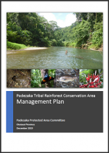
This Management Plan was prepared by the representatives of the Padezaka Tribe in partnership with the Natural Resources Development Foundation (NRDF), Integrated Forest Management Program (IFMP) and Ecological Solutions Solomon Islands (ESSI) in Choiseul.
Papua New Guinea Conservation Needs Assessment, Synopsis Report
The Conservation Needs Assessment (CNA) for Papua New Guinea was requested by the government of Papua New Guinea and funded by the U.S. Agency for International Development (USAID).
Papua New Guinea Policy on Protected Areas
This Policy on Protected Areas (the Policy) has been developed by the Government of Papua New Guinea to support the development and management of a National Protected Area Network in Papua New Guinea (PNG).
PARKS The International Journal of Protected Areas and Conservation, Issue 27 Special Issue on COVID-19 MARCH 2021
This special issue of PARKS is devoted to the impact and implications of COVID-19 on the world’s protected and conserved areas.
Participatory monitoring drives biodiversity knowledge in global protected areas
Protected areas are central in strategies to conserve biodiversity. Effective area-based conservation relies on biodiversity data, but the current biodiversity knowledge base is insufficient and limited by geographic and taxonomic biases.
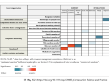
Partner support and interactions with communities show mixed effects on governance of community-based resources
Community-based natural resource management is recognized as an effective area-based conservation approach. Accordingly, conservation organizations worldwide are providing support to local communities seeking to sustainably manage and use their local natural resources.
Perceived Equity in Marine Management and Conservation : Exploring Gender Intersectionality in Fiji.
Understanding perceived equity is key, equity subjective, context-dependent and has implications for legitimacy, cooperation and wellbeing.
Perspectives on Marine Protected Areas
Different perspectives to best manage the Pacific Ocean in the interests of all who live there.
PICRC publishes study on longnose emperor spawning aggregation
Since 2023, the Palau International Coral Reef Center (PICRC) has been collaborating with the Koror State Government (KSG) to conduct research and monitoring aimed at providing essential baseline data to guide the Koror Southern Lagoon Coastal Fisheries Management Plan, a new fisheries management
PIPAP GIS Supplementary Training Video 1 : QGIS Basics
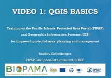
This package/collection of training materials constitute an introductory, basic-level training to open source GIS software (QGIS) targeting technical-level government officers.
PIPAP GIS Supplementary Training Video 2 : Building Maps in QGIS
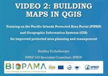
This package/collection of training materials constitute an introductory, basic-level training to open source GIS software (QGIS) targeting technical-level government officers.
PIPAP GIS Supplementary Training Video 3 : Mapping GPS Data in QGIS
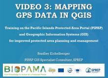
This package/collection of training materials constitute an introductory, basic-level training to open source GIS software (QGIS) targeting technical-level government officers.
Post-2020 biodiversity framework challenged by cropland expansion in protected areas
Protected areas (PAs) are essential for biodiversity conservation but are threatened by cropland expansion. Recent studies have only reported global cropland expansion in large PAs between 1990 and 2005.
Practice Standards for Debt Conversion Projects for Nature, Resilience, and People
Today the world faces three interconnected crises: biodiversity loss, climate change, and unsustainable debt, each greatly exacerbating the other.
Predicting the optimal amount of time to spend learning before designating protected habitat for threatened species
Deciding when to protect threatened species habitat when complete knowledge about the habitat extent is uncertain is a common problem in conservation. More accurate habitat mapping improves conservation outcomes once that habitat is protected.
Preserving paradise: the value of protecting Papua New Guinea's forests for climate
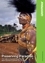
Papua New Guinea (PNG) hosts some of the world's largest and last remaining intact forest landscapes.
Principles for Ecosystem Restoration to Guide the United Nations Decade 2021-2030
Aware of the critical need to halt, prevent and reverse ecosystem degradation, and to effectively restore degraded terrestrial, freshwater and marine ecosystems across the globe, through Resolution 73/284, the United Nations General Assembly declared 2021–2030 as the United Nations Decade on Ecos
Priority Sites for Conservation in Kiribati: Key Biodiversity Areas
This KBA report outlines key recommendations for the Government of Kiribati and its people for protecting its unique biodiversity and supporting sustainable livelihoods. A total of twenty-two island KBAs were identified and suggested for immediate management.
Priority Sites for Conservation in the Cook Islands: Key Biodiversity Areas and Important Bird Areas
In 2010, with the assistance of Conservation International and the Critical Ecosystems Partnership Fund, Birdlife International in partnership with the Cook Islands environmental NGO Te Ipukarea Society commenced a project to identify and delineate KBAs and IBAs in the Cook Islands.
Progress Towards Protected Area Targets

Protected Area targets have been set globally, regionally, and sometimes at a country level.
Progress Towards the CBD Protected Area Management Effectiveness Targets
Coad, L. Leverington, F., Burgess, N., Cuadros, I., Geldmann, J., Marthews, T., Mee, J., Nolte, C., Stoll-Kleemann, S., Vansteelant, N., Zamora, C., Zimsky, M., Hockings, M.
Promoting Synergies Between Climate Change Adaptation and Biodiversity

This technical brief is a joint collaboration with the Nairobi work programme expert group on biodiversity and climate change adaptation and has been published as a supplement to the NAP technical guidelines.
Protect and restore: integrating marine management to secure the future of coastal ecosystems
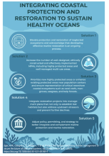
We must integrate effective protection with scalable restoration to ensure resilient coastal ecosystems.
Protected area connectivity: Shortfalls in global targets and country-level priorities
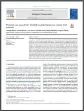
Connectivity of protected areas (PAs) is crucial for meeting their conservation goals.
Protected Area Governance and Management
The world’s more than 200 000 protected areas come in many forms, on land and at sea, and occur in every country (Bertzky et al. 2012). They are places that people establish to conserve natural and cultural heritage and to sustain their benefits for society.
Protected Area Governance and Management
This book has been prepared as a contribution to the IUCN World Parks Congress in Sydney in 2014. The global community is at the interface of ensuring the quality of protected area governance and management, together with the way that effectively managed and
Protected area management has significant spillover effects on vegetation
The Kunming–Montreal Global Biodiversity Framework calls for rapid global expansion of protected areas in response to ongoing biodiversity loss and ecosystem degradation1. One of its strongest selling points is the benefits protected areas provide to adjacent human communities2,3.
Protected Area Network Expansion and Management: Economics to improve conservation outcomes
This paper identifies the Dasgupta Review’s key points about the role of protected areas (PAs) in conserving nature.
Protected Area Short Courses in Australia, Asia and the Pacific: training issues, needs and recommendations
This report is the outcome of a review commissioned by the Protected Areas Learning and Research Collaboration (PALRC) in 2018, with the following aims:
Protected area targets post-2020
In 2010, Parties to the Convention on Biological Diversity (CBD) adopted the Strategic Plan for Biodiversity 2011–2020, and its 20 Aichi Biodiversity Targets, to catalyze national and international conservation efforts and reverse negative biodiversity trends.
Protected Areas and the Global Conservation of Migratory Birds
Runge, C. A., J. E. M. Watson, S. H. M. Butchart, J. O. Hanson, H. P. Possingham, and R. A. Fuller. 2015 .
Protected areas are now the last strongholds for many imperiled mammal species
The global network of terrestrial protected areas (PAs) has experienced a fourfold expansion since the 1970s.
Protected areas expanding fast but failing to halt nature loss, studies warn
New research suggests that the rapid expansion of protected areas worldwide is giving a misleading picture of progress, with biodiversity continuing to decline inside many sites designated for protection.
Protected areas in the world’s ecoregions: How well connected are they?
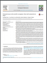
Protected areas (PAs) are the main instrument for biodiversity conservation, which has triggered the development of numerous indicators and assessments on their coverage, performance and efficiency.
Protected Areas Learning and Research Collaboration (PALRC)
Protected Areas Learning and Research Collaboration (PALRC)
The purposes of PALRC are to:
Protected Planet Report 2012 Tracking Progress Towards Global Targets for Protected Areas
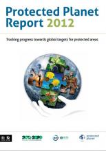
Bastian Bertzky, B., Corrigan, C., Kemsey, J., Kenney, S., Ravilious, C., Besançon, C. and Burgess, N.

Protected Planet Report 2020

We are entering an era of unparalleled opportunity to address the global crisis facing nature.
Protected-area targets could be undermined by climate change-driven shifts in ecoregions and biomes
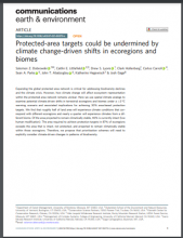
Expanding the global protected area network is critical for addressing biodiversity declines and the climate crisis. However, how climate change will affect ecosystem representation within the protected area network remains unclear.