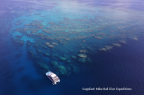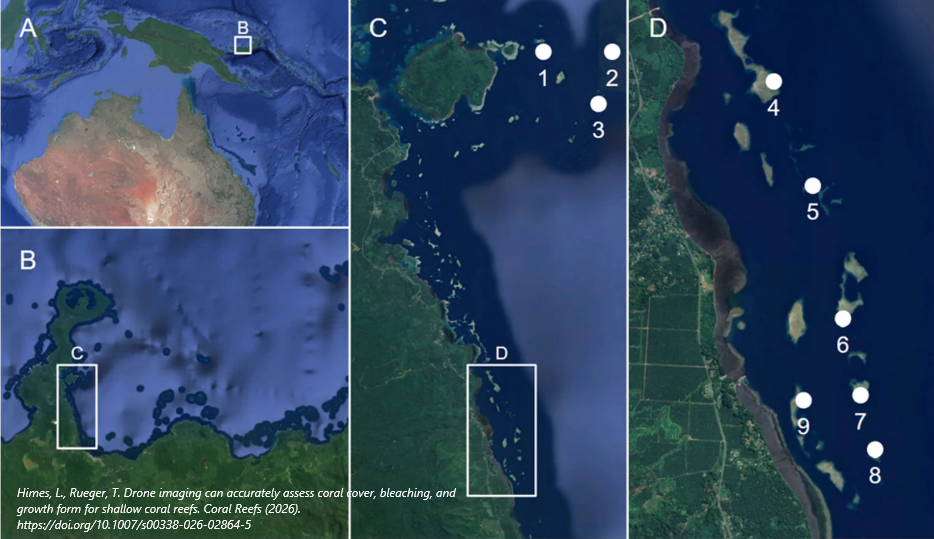
Assessing the impacts of rapid environmental change on coral reefs is hindered by a discrepancy between the regions with the greatest need and those that receive the most research funding. Remote sensing, particularly through the use of drones [or unoccupied aerial vehicles (UAVs)], has the potential to significantly enhance the accessibility and efficiency of high-quality data collection in remote, biodiverse areas such as the Coral Triangle. To test this, we compared a UAV-based method, a common citizen science method (Reef Check), and a research-grade method (photo quadrats) to assess hard coral cover, coral bleaching, and coral growth forms across reef types (nearshore, fringing, midshelf) and depths (crest, 5 m, 10 m, 15 m) in Kimbe Bay, Papua New Guinea, during the fourth Global Mass Coral Bleaching Event. We found that, compared to in-water methods, the UAV delivered accurate reef health data for shallow reef crests of all reef types, including hard coral cover, bleached hard coral cover, and coral growth forms. There were significant differences between methods for pale hard coral cover, but not for any other categories. Hard coral cover did not differ significantly between the crest and the other depths. However, bleaching was most significant at the reef crest, with 11% of total coral bleached and 24% pale. This decreased significantly at deeper parts of the reef slope, with under 1% of coral bleached or pale at 15 m. Coral growth form composition varied significantly between reef types, but the scale of these differences decreased with depth. Our study demonstrates that UAVs can provide accurate health and community composition data for reefs with high biodiversity, significantly enhancing the availability of high-quality reef health data in the areas of highest need.