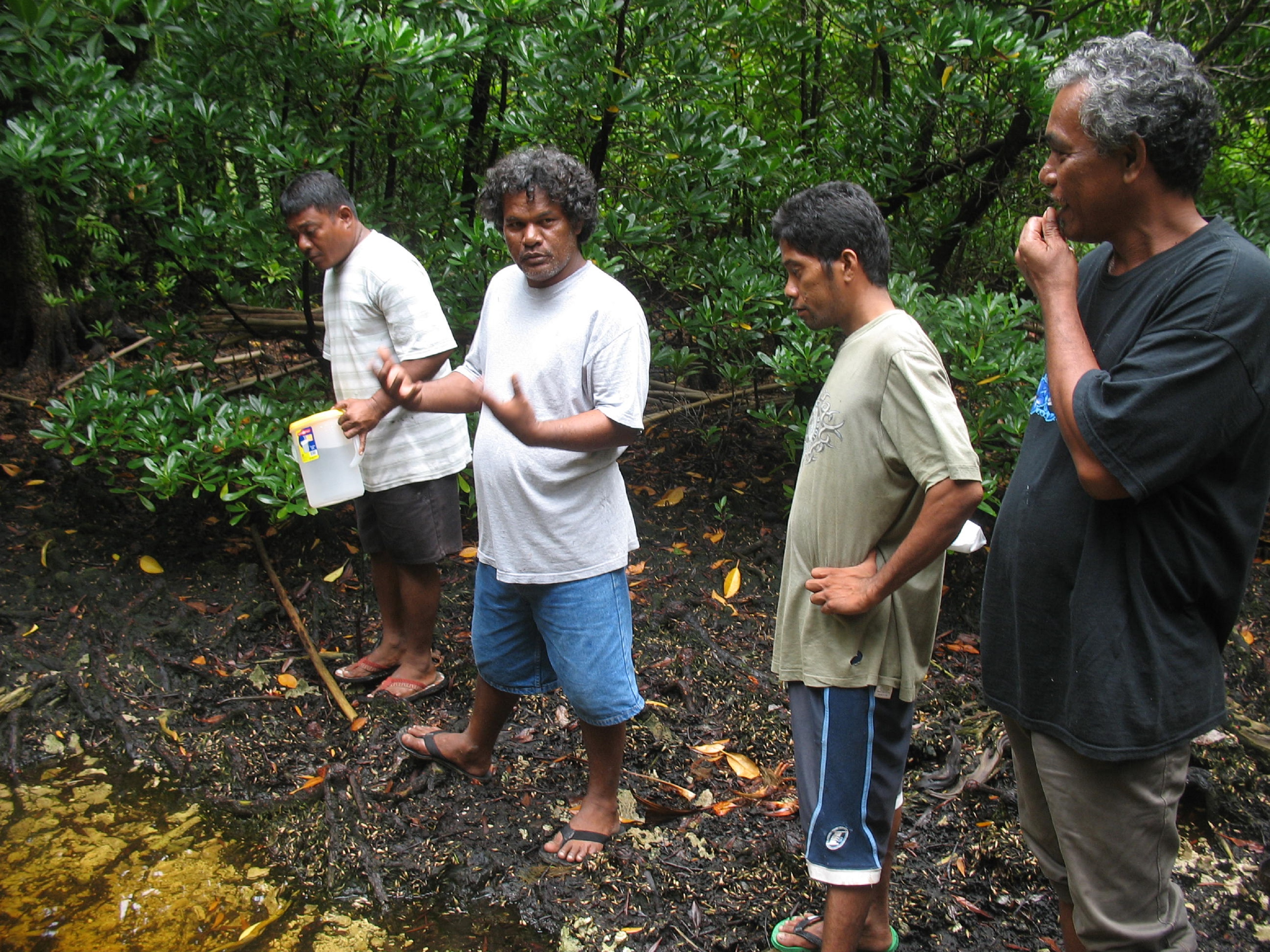
Community Based Management resources
IUCN RED LIST 60 years of success
Marking 60 years of The IUCN Red List of Threatened Species (IUCN Red List), this report captures its beginnings and tracks key milestones and achievements.
IUCN WCPA Technical Note - IMPROVING PROTECTED AND CONSERVED AREA MANAGEMENT TO SAFEGUARD ECOLOGICAL INTEGRITY AND MINIMISE ZOONOTIC DISEASE RISK
This Technical Note provides advice to managers of protected and conserved areas1 (PCAs) for applying a ‘One Health’ approach for the benefit of environmental, animal, and human health.
IUCN WCPA Technical Note 16: Approaches for identifying areas of particular importance for marine biodiversity
Identifying and conserving areas of particular importance for biodiversity is a fundamental element of the Kunming-Montreal Global Biodiversity Framework (GBF).
IUCN WCPA Technical Note No.25 - Enhancing climate change mitigation in protected areas: A practical guide for practitioners and decision-makers
Aim: To present a short, practical guide to integrate climate change mitigation (CCM) into Protected and Conserved Area (PCA) management and decision-making and as a companion to the WCPA technical report Enhancing climate change mitigation in protected areas.
Key Biodiversity Areas

Key Biodiversity Areas (KBAs) are the most important places in the world for species and their habitats. Faced with a global environmental crisis we need to focus our collective efforts on conserving the places that matter most.
Kipim Ol Sanbij Blong Vanuatu i sef Blong Ol Totel
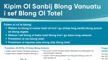
Folem ol rul ia blong:
Mekem isi blong ol mama totel oli krol i go antap long sanbij blong putum
ek blong olgeta
Mekem i sef blong ol bebe totel blong krol i go daon long solwota
Protektem ol nes blong totel
Kiribati National Marine Ecosystem Service Valuation
This study aimed to determine an economic value1 of seven marine and coastal ecosystem services in Kiribati.
Kiwa Initiative Capacity Needs Assessment for Implementing Nature-based Solutions for Climate Change Adaptation
This assessment identifies the capacity-building needs and priorities of local and national public authorities and institutions, representatives from civil societies and communities, and NGOs from the 19 Kiwa-eligible PICTs to: 1.
Kiwa Initiative launches a Pacific-wide campaign to strengthen understanding of Nature-based Solutions
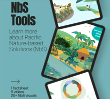
To celebrate its fifth anniversary, the Kiwa Initiative is launching a bilingual (French/English) awareness campaign aimed at strengthening understanding of Nature-based Solutions (NbS) among Pacific communities and practitioners.
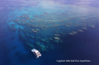
Large marine protected areas can encompass movements of diverse megafauna
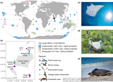
Global calls for greater ocean protection have sparked renewed interest in very large marine protected areas (VLMPAs, >100,000 km2) to achieve management targets; however, their conservation value is debated.
Launch of Takitumu Conservation Area as an OECM
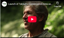
For Biodiversity Day 2024, the Cook Islands celebrated Ngai Taporoporo o Takitumu / Takitumu Conservation Area (TCA) as an Other Effective area-based Conservation Measure (OECM). This is the first OECM for the Cook Islands and for the Pacific.
Learning from Positive Deviance in Gender and Fisheries: A Case Study in Solomon Islands
We present an initial exploration of why and how participation in a case of community-based resource management (CBRM) in a Pacific context could be considered a deviation from gender norms.
Less diversity, higher risk of infection: Disturbed habitats can promote the spread of tropical disease

When night falls in Panama's forests, the time of the opossums begins. The marsupials, which have spent the day sleeping in trees, climb down the trunks and search for fruit, frogs or eggs on the ground. The omnivores often carry a hazardous parasite—the Chagas disease pathogen.
Leveraging deep learning and computer vision technologies to enhance management of coastal fisheries in the Pacific region
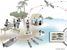
This paper presents the design and development of a coastal fisheries monitoring system that harnesses artificial intelligence technologies. Application of the system across the Pacific region promises to revolutionize coastal fisheries management.
Litter accumulation in tropical mangroves threatens biodiversity and local communities
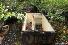
Mangroves, typical of tropical and subtropical latitudes, have become veritable natural traps for land- and sea-based waste.
Little-to-no industrial fishing occurs in fully and highly protected marine areas
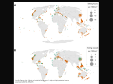
There is a widespread perception that illegal fishing is common in marine protected areas (MPAs) due to strong incentives for poaching and the high cost of monitoring and enforcement.
Locally-Managed Marine Areas: A Guide to Supporting Community-based Adaptive Management
Govan, H, Aalbersberg, W., Tawake, A. and Parks, J.E. 2008. The Locally-Managed Marine Area Network (LMMA)
Machine learning prediction of connectivity, biodiversity and resilience in the Coral Triangle
Even optimistic climate scenarios predict catastrophic consequences for coral reef ecosystems by 2100. Understanding how reef connectivity, biodiversity and resilience are shaped by climate variability would improve chances to establish sustainable management practices.
Making Money Local: Can Protected Areas Deliver Both Economic Benefits and Conservation Objectives?
This publication has been developed as a contribution to Phase II of the Two-phase Strategy on Protected Areas of the Secretariat of the Convention on Biological Diversity (CBD) and prepared pursuant to various paragraphs of COP decision XIII/2 on protected areas, in particular paragraph 5(a-e),
Making the global local Should the drive to 30x30 be locally led?
There has been a profound shift in attitudes towards the designation and management of site-based conservation over the past 25 years, from being a predominantly science-based, top-down and government-led approach to one that focuses on governance and equity, and is far more variable,
Malaysia's Timber Colony: Exposing Malaysia’s Grip Over Papua New Guinea’s Forests
Papua New Guinea (PNG) is a major exporter of tropical logs worldwide. This report investigates the role of Malaysian companies and individuals in large-scale forest clearance in PNG through the misuse of Forest Clearing Authorities (FCAs).
Management approach matters: meeting seagrass recovery and carbon mitigation goals
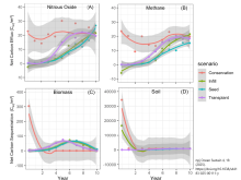
Seagrass habitats support biodiversity, improve water quality, protect coastlines, and sequester carbon, among other essential ecosystem functions, yet they are declining worldwide due to human activity.
Management of plan for the Ijuw/Anabar wetlands proposed conservation area (PCA) - Republic of Nauru
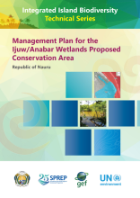
The management plan describes the priority strategies for the Ijuw/Anabar wetlands Proposed Conservation area (PCA) that will best maintain and improve the key conservation values in this area by reducing the impact of threats, including from climate change.
Management of Village Fisheries; Samoa’s Community-Based Management Strategy
King, M., Passfield, K. and Ropeti, R. 2001. Management of Village Fisheries; Samoa’s Community-Based Management Strategy
Management Plan Development
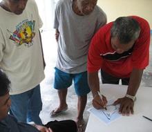
Presented here are examples of management plans for various kinds of protected areas from strict nature reserves to local village fisheries management plans. In addition, there is a discussion on the reasons for management plans and guidelines for writing a management plan.
Management Plan for Upland Areas of Lake Lanoto'o National Park, 2018-2023
The management plan describes the priority strategies for the upland areas of the Lake Lanoto'o National Park that will nest maintain and improve the key conservation values in these areas by reducing the impact of threats including from climate change.
Management Plan for Upland Areas of Lake Lanuto'o National Park, Samoa
The management plan describes the priority strategies for the upland areas of the Lake Lanuto'o National Park that will best maintain and improve the key conservation values in these areas by reducing the impact of threats, including from climate change.
Managing mynas (Acridotheres fuscus and A. tristis) in the Independent State of Samoa August, 2015 : a plan
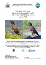
This document builds on lessons learned from 10 years of DEC-MNRE action on the myna issue, training workshops on invasive species management, a 2015 myna population transect survey (conservative estimate of total population in Samoa between 129,407 and 188,583 birds), appropriate literature and
Managing Watersheds for Coral Reefs and Public Health.
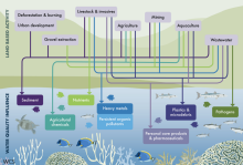
The health and integrity of coral reef ecosystems are in decline worldwide due to an increasing suite of human activities, which threaten biodiversity and human wellbeing. One of the major drivers of coral reef ecosystem decline is poor water quality from human activities on land.
Mangrove management plan for Fiji 2013
This report, the Mangrove Management Plan 2013 (MMP2013), has been prepared by Dr Dick Watling, Environment Consultants Fiji (ECF) for the Department of the Environment (DoEnv) as the focal point for the Mangrove Eco Systems for Climate Change Adaptation and Livelihood project Project (MESCAL).
Manual for Community Monitoring of Sea Grass Habitat in the Western Pacific
McKenzie, L.J. & Campbell, S.J. 2002 Western Pacific Edition (QFS, NFC, Cairns). Manual for Community Monitoring of Sea Grass Habitat in the Western Pacific
Manual for Mangrove Monitoring in the Pacific Islands Region
Ellison, J.C., Jungblut, V., Anderson, P., Slaven, C. 2012. Manual for Mangrove Monitoring in the Pacific Islands Region. SRPEP, Apia, Samoa.
Mapping global freshwater ecosystems to guide national restoration targets and nature-based solutions
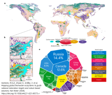
Freshwater ecosystems regulate the water cycle, support biodiversity and enhance resilience, yet they remain largely overlooked in global climate policies, and most national commitments lack clear, spatially defined targets for their protection and restoration.
Mapping the patriarchy in conservation
It is essential to ensure the effectiveness of current conservation efforts to meet the interconnected crises of biodiversity loss, habitat degradation, and climate change.
MAQTRAC Marine Aquarium Trade Coral Reef Monitoring Protocol Field Manual
Hodgson, G and Ochavillo, D. 2006. MAQTRAC Marine Aquarium Trade Coral Reef Monitoring Protocol Field Manual. Reef Check Foundation. Pacific Palisades, California USA.
Marine Atlas Maximising Benefits for Kiribati.
While the ocean covers more than two thirds of the Earth’s surface, the oceanic territory of Kiribati is morethan 4,000 times larger than its land territory. With an exclusive economic zone (EEZ) of 3.55 million km2,Kiribati is a large ocean state.
Marine Atlas, Maximising Benefits for Tonga
While the ocean covers more than two thirds of the Earth’s surface, the oceanic territory of Tonga is over 1,000 timeslarger than its land territory. With an exclusive economic zone (EEZ) of 700,000 km2, Tonga is a large ocean state.
Marine biodiversity law in Fiji, Solomon and Vanuatu Islands : final report
The research agreement signed on 19th December 2005 by the Institute of Research for Development (IRD), the University Paul Sabatier (Toulouse III) and Nantes University, the Pharmacochemical laboratories of Natural Substances and Pharmacophores Redox (UMR 1165) and the Centre of Maritime and Oce
Marine Bioregions of Fiji.
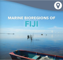
Marine spatial planning is underway now, or starting, in many Pacific Island countries, including Fiji.
Marine Bioregions of the Solomon Islands
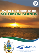
Marine spatial planning is underway now, or starting, in many Pacific Island countries, including the Solomon Islands.
Marine Bioregions of Tonga
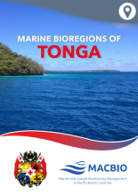
Marine spatial planning is underway now, or starting, in many Pacific Island countries, including Tonga.
Marine Bioregions of Vanuatu
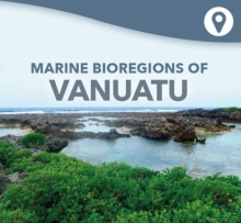
In 2014, the Council of Ministers (Decision No. 172/2014) decided to start implementation of, amongst other things, a Marine Spatial Plan for the nation.
Marine protected areas as living labs? Lessons learned & future perspectives
Marine Protected Areas (MPAs) management usually involves bringing multiple stakeholders together, to construct policy-relevant research programs and science-based tools for adaptive management.
Marine Sanctuary Management Plan, Pacific BioScapes Programme - Samoa
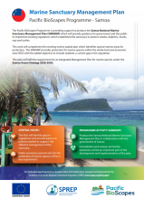
The Pacific BioScapes Programme is providing support to produce the Samoa National Marine Sanctuary Management Plan (SNMSMP) which will provide guidance for government and the public to implement existing regulations which established the sanctuary to protect whales, dolphins, sharks, rays and tu
Marine spatial planning and ocean governance in Small Island Developing States
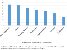
Marine spatial planning (MSP), initially developed to address the needs of the global North, is gaining significant traction in Small Island Developing States (SIDS) and is hailed as a collaborative governance instrument for managing and optimizing the allocation of ocean space.
Marine spatial planning in ocean governance: Fijian perspectives
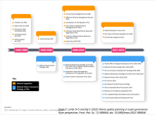
Marine Spatial Planning (MSP) is a globally established tool to support integrated ocean management.
Marine Spatial Planning, Pacific BioScapes Programme - Cook Islands
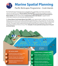
The Pacific BioScapes Programme aims to strengthen the sustainable use of marine and coastal resources through the use of Marine Spatial Planning (MSP) to achieve key ecological, economic, cultural and social objectives.
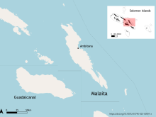
Marine Turtle Status report for Solomon Islands 2022
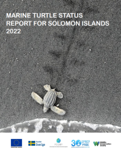
The marine turtle states review for Solomon Islands 2022 was commissioned to inform the development of the country's 5-year National plan of Action (NPOA) - Marine Turtles 2022-2026.